150x150.png)
Rural mobility has always sat slightly off-centre in the ITS conversation, acknowledged as important but rarely treated as a strategic frontier. The sector’s main attention gravitates toward cities with dense networks, rich datasets, multimodal complexity, political visibility, and the sheer volume of daily movement. Yet the quiet truth is that rural mobility presents some of the most stubborn, structural challenges in transport, challenges that cannot be solved by simply exporting urban thinking into low-density landscapes. Rural areas demand a different mindset, a different technological palette, and a different understanding of what mobility means when distance is long, demand is thin, and connectivity is patchy.
The starting point is recognising that rural mobility is not a scaled-down version of urban mobility. It is a fundamentally different operating environment. In cities, transport planners can rely on predictable flows, high utilisation, and a constant stream of data from connected devices, roadside units, and public transport systems. Rural networks, by contrast, are characterised by long stretches of infrastructure with minimal instrumentation, limited cellular coverage, and traffic patterns that fluctuate dramatically by season, time of day, and local economic activity. A single agricultural event, a school closing time, or a shift change at a regional employer can reshape the entire mobility picture for miles around.
This variability makes traditional ITS deployments difficult to justify. The business case for roadside units, fibre backhaul, or dense sensor networks collapses when utilisation is low and maintenance costs are high. Rural authorities often operate with constrained budgets and limited technical capacity, making it harder to adopt emerging technologies even when the long-term benefits are clear. The result is a widening digital divide where cities accelerate toward connected, data-driven mobility ecosystems while rural areas risk being left with analogue infrastructure and reactive operations.
Yet rural mobility is not simply a matter of equity. It is a matter of national resilience. Rural roads carry freight, agricultural produce, energy infrastructure, and tourism traffic. They connect dispersed communities to essential services. They underpin emergency response, social care, and economic participation. When rural mobility fails, the consequences ripple far beyond the communities directly affected. This is why ITS for rural environments deserves more than a footnote in national transport strategies. It requires deliberate design.
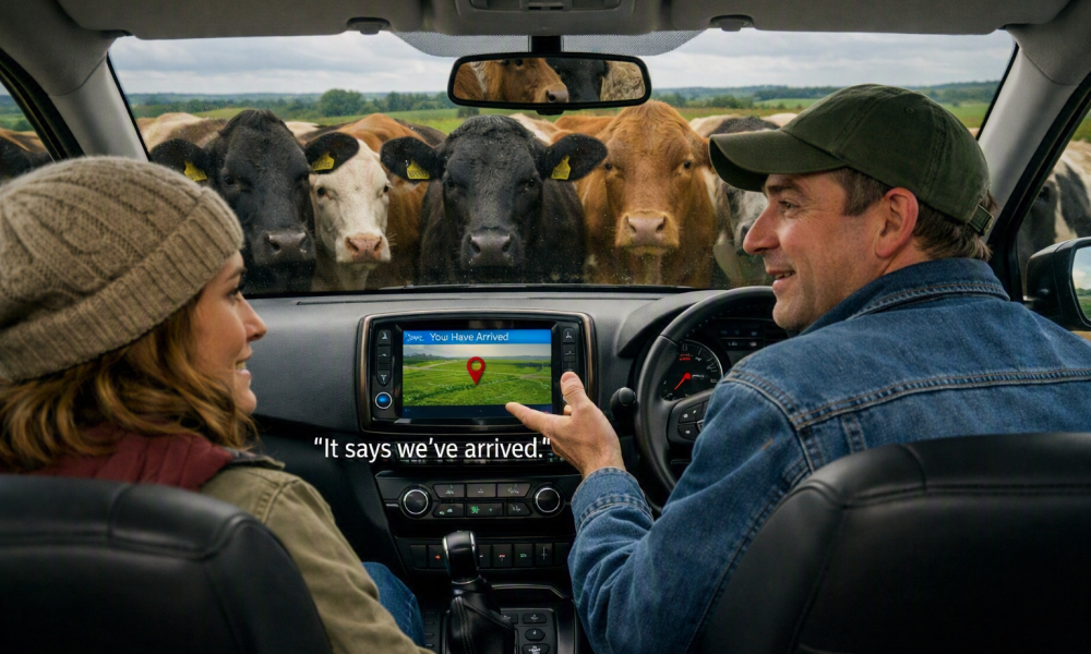
One of the most overlooked foundations of rural ITS is accurate mapping. In cities, digital maps are refreshed constantly, fed by high-density sensor networks and continuous updates from commercial providers. Rural areas, however, often suffer from outdated or incomplete mapping, with incorrect property access points, missing private roads, and poorly represented non-vehicular rights-of-way. This matters. Emergency services rely on precise access information. Freight operators need clarity on turning radii, weight restrictions, and farm-gate locations. Demand-responsive transport cannot optimise routes if the system believes a farmhouse driveway is half a mile from where it actually is. Even connected vehicle warnings depend on accurate geofencing of hazards, pinch points, and permissive paths.
Rural mobility is deeply intertwined with land use, and land use is rarely simple. A single property may have multiple access points, seasonal entrances, or rights-of-way that intersect with bridleways, footpaths, permissive tracks, or farm lanes. Understanding these nuances is essential for routing, safety, and service planning. Modern mapping technologies, ranging from high-resolution aerial imagery to crowdsourced updates and machine-learning-based feature extraction, can finally bring rural geographies into the digital fold. When combined with local knowledge from parish councils, landowners, and community groups, mapping becomes a living asset rather than a static backdrop. Accurate geospatial data is not a luxury, this is the bedrock on which rural ITS must be built.
Beyond mapping, rural areas benefit from technologies that thrive in sparse environments:
These can provide coverage where traditional communications infrastructure is impractical. Battery-powered roadside sensors, capable of transmitting small packets of data over long distances, offer a cost-effective way to monitor traffic, weather, and road conditions. These devices do not need the bandwidth of urban ITS, what they need is reliability, longevity, and the ability to operate autonomously for years at a time.
Connected vehicle data also has enormous potential. When roadside infrastructure is limited, vehicles become the sensors. Modern cars and commercial fleets generate rich streams of information about speed, braking, traction, and location. Aggregated and anonymised, this data can reveal patterns that would otherwise be invisible, such as icy patches forming on shaded bends, livestock movements affecting local roads, or sudden congestion caused by an incident which is miles from the nearest traffic camera. Rural authorities can use these insights to target maintenance, deploy resources, and improve safety without installing extensive hardware.
Public transport presents another challenge. Fixed-route services struggle in low-density areas because demand is too dispersed to sustain frequent timetables. Demand-Responsive Transport (DRT) has long been proposed as a solution, but early deployments often suffered from poor integration, limited booking options, and operational inefficiencies. Modern ITS can change this. Real-time optimisation algorithms, integrated ticketing, and multimodal journey planning can make DRT genuinely viable, aligning vehicle movements with actual demand rather than rigid schedules. When combined with community transport, school services, and healthcare shuttles, rural mobility can become a coordinated ecosystem rather than a patchwork of isolated offerings.
Safety is another area where ITS can make a disproportionate impact. Rural roads account for a significant share of serious collisions, often due to speed, visibility, and environmental conditions. Intelligent speed assistance, in-vehicle warnings, and geofenced safety zones can help drivers navigate challenging routes more safely. Meanwhile, digital mapping of roadside hazards, from narrow bridges to sharp bends, can feed into navigation systems, giving drivers better situational awareness even when signage is limited.
There is also a cultural dimension to rural ITS. Technology must be introduced in ways that respect local identity and community expectations. Rural residents may be wary of surveillance, sceptical of automation, or protective of traditional mobility patterns. Successful deployments therefore depend on trust, transparency, and clear communication about benefits. When communities understand that ITS can support independence, improve access to services, and enhance safety without eroding local character, adoption becomes far easier.
The future of rural mobility will likely be shaped by hybrid solutions:
The common thread is that rural ITS will not be defined by a single technology but by a flexible, adaptive approach that blends connectivity, data, and local knowledge.
Ultimately, the overlooked challenge of rural mobility is not technological complexity but strategic neglect. Rural areas matter. They deserve the same level of innovation, investment, and imagination that cities receive. The ITS community has an opportunity, and arguably an obligation, to rethink how mobility works beyond the urban boundary. By designing systems that respect the realities of low density, low connectivity, and the intricacies of rural geography, we can build transport networks that are not only smarter but fairer, more resilient, and more attuned to the diverse landscapes they serve.
Click the buttons below to see more articles:
See all ArticlesIndustry InsightEventsITS Thought LeadershipITS Educational